

Thanksgiving Break Forecast Brings Mild Travel Weather Before Weekend Arctic Blast
Students heading into Thanksgiving break can expect mostly calm and seasonably cool weather for travel across Oklahoma this week, but a major pattern shift is coming by the weekend.
Light rain and drizzle moved through parts of the state early Monday, leaving behind thick clouds and cooler temperatures to start the week. Highs on Monday are expected to reach the upper 50s and low to mid-60s, with a few isolated showers possible later this afternoon and evening. The highest rain chances will be in northern and eastern Oklahoma, while western areas remain dry with more sunshine.
A weak front will push across the state today, bringing a northwest breeze and keeping highs in the 50s and 60s. Overnight, skies will clear, and temperatures will drop into the 30s and 40s.
A reinforcing push of chilly air arrives Tuesday, bringing breezy to gusty north winds but plenty of sunshine. The cooldown becomes more noticeable by Wednesday, when highs dip into the 40s and 50s under light north winds and thin, high clouds.
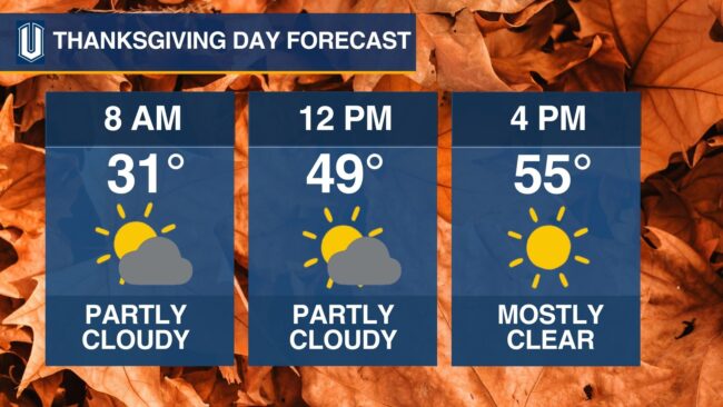
Thanksgiving Day will bring ideal travel and outdoor conditions statewide. Forecasts call for partly cloudy skies and temperatures in the mid-50s, making it one of the most pleasant days of the week.
However, conditions take a dramatic turn by the weekend. A strong arctic cold front is expected to move in on Saturday, sending highs tumbling into the 20s and 30s and producing single-digit wind chills. Forecasters are watching closely for the potential of winter precipitation from Sunday through Tuesday, which could impact the end of the holiday break and travel back to campus.
Students planning outdoor activities such as hanging Christmas lights or running errands are encouraged to stay weather aware and take advantage of the mild stretch early in the week before the arctic blast arrives.